


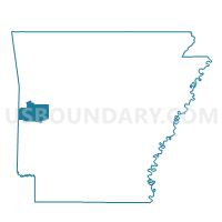
Cedar Voting District, Scott County, Arkansas
About
Outline

Summary
| Unique Area Identifier | 528097 |
| Name | Cedar Voting District |
| County | Scott County |
| State | Arkansas |
| Area (square miles) | 54.13 |
| Land Area (square miles) | 53.87 |
| Water Area (square miles) | 0.26 |
| % of Land Area | 99.51 |
| % of Water Area | 0.49 |
| Latitude of the Internal Point | 34.77913440 |
| Longtitude of the Internal Point | -93.84349700 |
Maps


Graphs
Select a template below for downloading or customizing gragh for Cedar Voting District, Scott County, Arkansas


Neighbors
Neighoring Voting District (by Name) Neighboring Voting District on the Map
- Lafave Voting District, Scott County, AR
- Little Texas Voting District, Scott County, AR
- Mill Creek Voting District, Scott County, AR
- Oden Out Voting District, Montgomery County, AR
- Parks Voting District, Scott County, AR
Top 10 Neighboring County Subdivision (by Population) Neighboring County Subdivision on the Map
- Oden township, Montgomery County, AR (944)
- Mill Creek township, Scott County, AR (322)
- Parks township, Scott County, AR (184)
- La Fave township, Scott County, AR (110)
- Cedar township, Scott County, AR (93)
- Little Texas township, Scott County, AR (16)
Top 10 Neighboring Unified School District (by Population) Neighboring Unified School District on the Map
- Waldron School District, AR (9,473)
- Two Rivers School District, AR (7,182)
- Ouachita River School District, AR (4,356)